İstinye/Στένης
- yasmineakaki
- Aug 27, 2025
- 4 min read
Updated: Sep 1, 2025

Along the shore line of the Bosphorus following the neighborhoods of Tarabya and Yeniköy, İstinye finds itself in a unique geography growing along the coast of the deepest and widest gulf of the Bosphorus. The neighborhood can be divided into two regions with the Kalafat area including the coast and northern slope overlooking the bay and the neighborhood’s valley and many streams inland from the coastline referred to as Inner İstinye. İstinye has been inhabited since the Byzantine era when imperial palaces were built in the region. Early names for the region include Steni (Στενή) or Stenos-Stenon both of which in Greek reference narrowness due to the neighborhood's proximity to the narrowest part of the Bosphorus. The neighborhood was also referred to as Leosthenion (Λεωσθένιον) for a plant that grew in the area and Sosthenion (Σωσθένιον) for a temple whose erection is often attributed to the Argonauts who dedicated it to Zeus Sosthenios and would become the Pammegiston Taxiarchon Church.
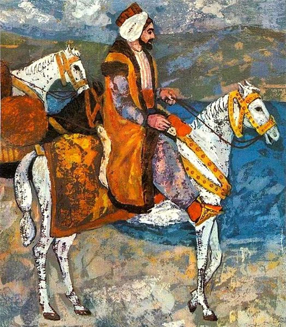
İstinye has been continuously inhabited and developed since the mid-sixteenth century. It appears in many travel accounts from the seventeenth and eighteenth centuries. Traveler Evliya Çelebi who visited the neighborhood in 1631 wrote of many of İstinye’s institutions such as a bathhouse that was frequented by beggars and a church that remained in ruins in the village. He also described that both Greeks and Muslims lived in the neighborhood running twenty or so shops. According to his account, most of the neighborhood's inhabitants made a living from fishing and gardening and the coast was dotted with a few yalı (waterside mansions). Ğugas İnciciyan, an Armenian Catholic monk and writer, corroborates these accounts in his writings from the eighteenth century describing that gardens and mansions lined the coast from İstinye all the way to Yeniköy.

İstinye’s economics is marked by its location as a strategic gulf in the Bosphorus. It served as a naval base for the Genoese and the Ottomans. In the second half of the nineteenth century a shipyard was established with the issuing of a building permit in 1856. The İstinye Ferry Pier was another important landmark for the coastal neighborhood with a twice-daily ferry service established by Şirket-i Hayriye in 1851. The İstinye Port continued its activities with a ship repair dock and shipyard through the Constitutional and Republic periods until it was shut down in 1991.
The inhabitants of İstinye included Greeks, Muslims, and Armenians most of whom worked as either sailors or cultivated produce in the gardens that sprawled across the region. The major crops grown were strawberries alongside the maintenance of vineyards and vegetable gardens. Inhabitants of the neighborhood also worked in lime and stone quarries in the surrounding hills as well as in the collection of clay from the İstinye and Büyükdere hills that was used in pottery production. For those that worked by the water, the port managed a caulking area for the repair of large ships that began operation in the eighteenth century.

In addition to the average inhabitants of the neighborhood, İstinye attracted wealthy members of the city to build yalıs alongside the coast. While a centuries long presence of yalıs on both shores of the İstinye gulf signified the neighborhood as a popular destination for wealthy city dwellers, its popularity grew especially in the mid and late nineteenth century likely due to the establishment of a ferry connection. Many of these seaside mansions were owned by wealthy Armenian businessmen. A prominent figure that built a mansion near the İstinye Pier was Recaizade Mahmud Ekrem, a poet and novelist. In addition to writing, he also taught literature at Galatasaray Sultanisi and Mülkiye Mektebi. His home in İstinye was referred to as the “Writers Mansion” as he hosted many salons and events with prominent and up and coming writers. He, alongside other poets and writers of the late nineteenth and early twentieth centuries, such as Muhtar Yahya Dağlı and Nâbizâde Nâzım, featured İstinye in his writings.
Landmarks
An 1845 map of Istanbul created by students of the Imperial School of Naval Engineering (Mühendishane-i Berri-i Hümayun) made note of a few landmarks in İstinye including it’s gulf, police office, and the İstinye Gardens. The İstinye police station was built in 1834 and was among the first police stations built in the empire style. The neighborhood also housed four mosques with the earliest, the Neslişah Sultan Mosque built in the 1540s. Sultan Abdulhamid I built a fountain in 1783 near this mosque. Near the Neslişah Sultan Mosque was a wooden bathhouse that is likely the one that appears in the work of Evliya Çelebi.

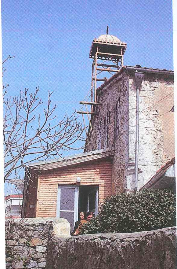
The Greek community in İstinye worshiped in the Pammegiston Taxiarchon Church (Ιερός Ναός Παμμεγίστων Ταξιαρχών). Originally a pagan temple, the church was first constructed by Emperor Constantine I in the fourth century and was dedicated to the Archangel Michael. Holy relics from a Byzantine ship are housed in the church including a rare double-sided icon of the archangel. The church fell into disrepair and was destroyed during the Conquest of Constantinople. The current structure of the church was renovated in 1820 and it also housed an hagiasma. In addition to the church, a school for Greek students was built in 1872 funded by a Greek educational society.
References:
Artan, Tülay. “Eyüp.” In Türkiye Diyanet Vakfi İslâm Ansiklopedisi. İsam Türkiye Diyanet Vakfi.
Özcan, Abdülkadir. “Karlok.” In Türkiye Diyanet Vakfi İslâm Ansiklopedisi. İsam Türkiye
Diyanet Vakfi.
Münir Aktepe, M. “Abdülhamid I.” In Türkiye Diyanet Vakfi İslâm Ansiklopedisi. İsam Türkiye
Diyanet Vakfi.
Selçuk, İklil. “Social Stratification In Ottoman Istanbul.” In From Antiquity to the 21st
Century: History of Istanbul. Türkiye Diyanet Foundation Center for Islamic Studies.
Şenyurt, Oya. 2020. “Attempts for the Construction of Three Greek Schools in Yeniköy After
the Mid-19th Century.” Modular Journal 3 (2): 107-128.
Tayar, İlhan. 2002. İstinye. Istanbul: Çitlembik.
Tayyib Gökbilgin, M. “Boğaziçi.” In Türkiye Diyanet Vakfi İslâm Ansiklopedisi. İsam Türkiye
Diyanet Vakfi.
Yılmaz, Coşkun. “Insights From an 1845 Map of Istanbul.” In From Antiquity to the 21st
Century: History of Istanbul. Türkiye Diyanet Foundation Center for Islamic Studies.


Comments